CARTA DE NAVEGACIÓN COSTERA

Taxonomía

Código

Nota(s) sobre el alcance

Nota(s) sobre el origen

Mostrar nota(s)

Términos jerárquicos

CARTA DE NAVEGACIÓN COSTERA

Términos equivalentes

CARTA DE NAVEGACIÓN COSTERA

Términos asociados

CARTA DE NAVEGACIÓN COSTERA

2 Descripción archivística results for CARTA DE NAVEGACIÓN COSTERA

2 resultados directamente relacionados Excluir términos relacionados

SUSA TO MAHEDIA WITH THE KURIAT ISLANDS

  • ES EXPONAV CARTAS NÁUTICAS CCN-000194
  • Unidad documental simple
  • 1864
  • Parte deCARTAS NÁUTICAS

Zona Geográfica: Mar Mediterráneo. Túnez
Aparece el golfo de Monastir y las islas Kuriat.
Contiene una recuadro con el fondeadero de Monastir a escala 1:40400 y otro recuadro con el fondeadero de Mahedia a escala 1:40400

INSTITUTO HIDROGRÁFICO INGLATERRA

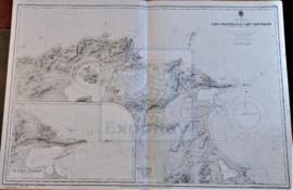
LES FRATELLI TO CAP CARTHAGE

  • ES EXPONAV CARTAS NÁUTICAS CCN-000179
  • Unidad documental simple
  • 1936
  • Parte deCARTAS NÁUTICAS

Zona Geográfica: Mar Mediterráneo. Costa norte de Túnez
Aparece la costa tunecina con los lagos de Lishkoel, Bizerte y Porto Farina y el golfo de Túnez.

INSTITUTO HIDROGRÁFICO FRANCIA