DU CAP FERRAT À LA POINTE KEF EL ASFER
- ES EXPONAV CARTAS NÁUTICAS CCN-000317
- Item
- 1926
Part of CARTAS NÁUTICAS
Zona Geográfica: Costa de Argelia. Mar Mediterráneo
Golfo de d'Arzeu, ciudad de Arzeu, Mostaganem.
INSTITUTO HIDROGRÁFICO FRANCIA
118 results directly related Exclude narrower terms
DU CAP FERRAT À LA POINTE KEF EL ASFER
Part of CARTAS NÁUTICAS
Zona Geográfica: Costa de Argelia. Mar Mediterráneo
Golfo de d'Arzeu, ciudad de Arzeu, Mostaganem.
INSTITUTO HIDROGRÁFICO FRANCIA
Part of CARTAS NÁUTICAS
Zona Geográfica: Guinea Portuguesa
Plano con las bahías de Sucujaque y Varela; islas de Ongueringao, de Jeta y de Elia; cabo da Mata, canal de Jeta; río Cacheu
INSTITUTO HIDROGRÁFICO PORTUGAL
Part of CARTAS NÁUTICAS
Zona Geográfica: Guinea Portuguesa
Canales de Caio, Meio, Geba, Caravela.
Islas Caravela, Jeta, Pecixe
INSTITUTO HIDROGRÁFICO PORTUGAL
CARNSORE POINT TO BRAICH-Y-PWLL
Part of CARTAS NÁUTICAS
Zona Geográfica: Canal de San Jorge
Plano del canal de San Jorge y la bahía de Cardigan con las ciudades de Pembrokeshire y Merionetshire.
INSTITUTO HIDROGRÁFICO INGLATERRA
Part of CARTAS NÁUTICAS
Zona Geográfica: República Dominicana
Plano de la costa y la bahía de Santo Domingo. Recuadros con las costas del puerto de Trujillo, de San Pedro de Marcorís, el puerto de San Andrés y río Romana.
INSTITUTO HIDROGRÁFICO INGLATERRA
BARRA HEAD TO SKYE INCLUDING THE SMALL ISLES
Part of CARTAS NÁUTICAS
Zona Geográfica: Costa Oeste de Escocia
Canal de las Hébridas con las islas de Rhum, Skye, Barra y el sur de Uist. Pequeñas islas como Canna, Eigg o Muck
INSTITUTO HIDROGRÁFICO INGLATERRA
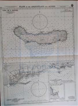
Part of CARTAS NÁUTICAS
Zona Geográfica: Océano Atlántico
Recuadro con la isla de San Miguel
INSTITUTO HIDROGRÁFICO INGLATERRA
Part of CARTAS NÁUTICAS
Zona Geográfica: Costa Sur de Inglaterra
Costa de Inglaterra desde Dodman hasta Start, con la ciudad de Plymouth y un recuadro con las rocas de Eddystone
INSTITUTO HIDROGRÁFICO INGLATERRA
APPROACHES TO THE BRISTOL CHANNEL
Part of CARTAS NÁUTICAS
Zona Geográfica: Costa Oeste de Inglaterra
Carta que representa los alrededores del canal de Bristol
INSTITUTO HIDROGRÁFICO INGLATERRA
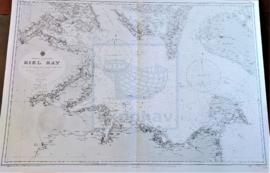
Part of CARTAS NÁUTICAS
Zona Geográfica: Mar Báltico
Aparecen la bahía de Kiel y las tierras de Lolland, Holstein y la isla Fehmarn
INSTITUTO HIDROGRÁFICO ALEMANIA