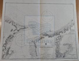
- ES EXPONAV CARTAS NÁUTICAS CCN-000038
- Item
- 1879
Part of CARTAS NÁUTICAS
Zona Geográfica: Mediterráneo
Costas de Sardinia y Orsica incluyendo las islas Magdalena, Caprera, Spargui, Lavezzi y Cavallo.
INSTITUTO HIDROGRÁFICO INGLATERRA
324 results directly related Exclude narrower terms
Part of CARTAS NÁUTICAS
Zona Geográfica: Mediterráneo
Costas de Sardinia y Orsica incluyendo las islas Magdalena, Caprera, Spargui, Lavezzi y Cavallo.
INSTITUTO HIDROGRÁFICO INGLATERRA
CARNSORE POINT TO BRAICH-Y-PWLL
Part of CARTAS NÁUTICAS
Zona Geográfica: Canal de San Jorge
Plano del canal de San Jorge y la bahía de Cardigan con las ciudades de Pembrokeshire y Merionetshire.
INSTITUTO HIDROGRÁFICO INGLATERRA
Part of CARTAS NÁUTICAS
Zona Geográfica: República Dominicana
Plano de la costa y la bahía de Santo Domingo. Recuadros con las costas del puerto de Trujillo, de San Pedro de Marcorís, el puerto de San Andrés y río Romana.
INSTITUTO HIDROGRÁFICO INGLATERRA
JAMAICA AND THE PEDRO BANK WITH PARTS OF CUBA AND HAITÍ
Part of CARTAS NÁUTICAS
Zona Geográfica: Indias Occidentales
Plano de Jamaica y Pedro Bank con partes de las islas de Cuba, Haití y Santo Domingo
INSTITUTO HIDROGRÁFICO INGLATERRA
Part of CARTAS NÁUTICAS
Zona Geográfica: Costa sur de Irlanda
Entrada en el puerto de Cork en el que aparecen las principales ciudades como Camden, Carlisle o la isla de Spike.
INSTITUTO HIDROGRÁFICO INGLATERRA
BARRA HEAD TO SKYE INCLUDING THE SMALL ISLES
Part of CARTAS NÁUTICAS
Zona Geográfica: Costa Oeste de Escocia
Canal de las Hébridas con las islas de Rhum, Skye, Barra y el sur de Uist. Pequeñas islas como Canna, Eigg o Muck
INSTITUTO HIDROGRÁFICO INGLATERRA
Part of CARTAS NÁUTICAS
Zona Geográfica: Costa oeste de Italia. Mar Mediterráneo
Costa de Italia desde Nápoles hasta el cabo Bonifacio. Aparece el golfo de Salerno.
INSTITUTO HIDROGRÁFICO INGLATERRA
Part of CARTAS NÁUTICAS
Zona Geográfica: Océano Atlántico Norte
Plano de la bahía de las Palmas, bahía del Confital y entre medias la Isleta.
INSTITUTO HIDROGRÁFICO INGLATERRA
Part of CARTAS NÁUTICAS
Zona Geográfica: Océano Atlántico
Recuadro con la isla de San Miguel
INSTITUTO HIDROGRÁFICO INGLATERRA
Part of CARTAS NÁUTICAS
Zona Geográfica: Costa Sur de Inglaterra
Costa de Inglaterra desde Dodman hasta Start, con la ciudad de Plymouth y un recuadro con las rocas de Eddystone
INSTITUTO HIDROGRÁFICO INGLATERRA