COBH AND PORT OF CORK Add to clipboard ES EXPONAV CARTAS NÁUTICAS CCN-000060 Item 1888 Part of CARTAS NÁUTICAS Zona Geográfica: Costa sur de IrlandaEntrada en el puerto de Cork en el que aparecen las principales ciudades como Camden, Carlisle o la isla de Spike. INSTITUTO HIDROGRÁFICO INGLATERRA
PLANS IN THE ISLAS CANARIAS Add to clipboard ES EXPONAV CARTAS NÁUTICAS CCN-000070 Item 1950 Part of CARTAS NÁUTICAS Zona Geográfica: Océano Atlántico NortePlano de la bahía de las Palmas, bahía del Confital y entre medias la Isleta. INSTITUTO HIDROGRÁFICO INGLATERRA
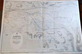
QUEENSTOWN AND PORT OF CORK Add to clipboard ES EXPONAV CARTAS NÁUTICAS CCN-000059 Item 1888 Part of CARTAS NÁUTICAS Zona Geográfica: Costa sur de IrlandaPlano de la ciudad de Queenstown y el puerto de Cork INSTITUTO HIDROGRÁFICO INGLATERRA