CAPE SIERRA LEONO TO TURTLE ISLANDS
Zona Geográfica: Costa oeste de África
Proximidades de Sierra Leona y Sherbo. Puerto de Freetown y las islas Banana y Tortuga
INSTITUTO HIDROGRÁFICO INGLATERRA
PRAWLE POINT TO HENGISTBURY HEAD
Zona Geográfica: Costa sur de Inglaterra
Tierras de Devonshire, Dorsetchire, Hampshire y la bahía Lyme
INSTITUTO HIDROGRÁFICO INGLATERRA
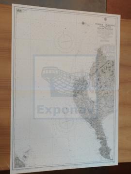
RIVER TYNE TO ST. ABBS HEAD
Zona Geográfica: Costa este de Inglaterra
Tierras de Northumberland, mar del Norte y el río Tyne
INSTITUTO HIDROGRÁFICO INGLATERRA
SHETLAND ISLES
Zona Geográfica: Islas británicas
Islas Shetland (Mainland, Yell y Unst)
INSTITUTO HIDROGRÁFICO INGLATERRA
FIRTH OF SOLWAY
Zona Geográfica: Costa oeste de Inglaterra
Aparecen las tierras de Cumberland, Dumfries y Kirkcudbright.
INSTITUTO HIDROGRÁFICO INGLATERRA
ISLAND OF ISLAY
Zona Geográfica: Costa oeste de Escocia
Aparecen las islas de Islay y Jura; bahía de Laggan
INSTITUTO HIDROGRÁFICO INGLATERRA
CAYO MOA GRANDE TO CAPE MAYSI
Zona Geográfica: Costa norte de Cuba. Indias Occidentales
Aparecen el cabo Maysi, great Inagua y Winward passage
INSTITUTO HIDROGRÁFICO ESTADOS UNIDOS DE AMÉRICA