PRAWLE POINT TO HENGISTBURY HEAD
- ES EXPONAV CARTAS NÁUTICAS CCN-000170
- Item
- 1957
Part of CARTAS NÁUTICAS
Zona Geográfica: Costa sur de Inglaterra
Tierras de Devonshire, Dorsetchire, Hampshire y la bahía Lyme
INSTITUTO HIDROGRÁFICO INGLATERRA
18 results with digital objects Show results with digital objects
PRAWLE POINT TO HENGISTBURY HEAD
Part of CARTAS NÁUTICAS
Zona Geográfica: Costa sur de Inglaterra
Tierras de Devonshire, Dorsetchire, Hampshire y la bahía Lyme
INSTITUTO HIDROGRÁFICO INGLATERRA
PUERTO CABELLO TO RIO ORINOCO AND THE LESSER ANTILLES TRINIDAD TO MARTINIQUE
Part of CARTAS NÁUTICAS
Zona Geográfica: Venezuela. América del Sur
Aparece el mar del Caribe, Venezuela, islas Windward y las islas de Trinidad y Tobago.
INSTITUTO HIDROGRÁFICO ESTADOS UNIDOS DE AMÉRICA
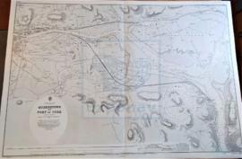
Part of CARTAS NÁUTICAS
Zona Geográfica: Costa sur de Irlanda
Plano de la ciudad de Queenstown y el puerto de Cork
INSTITUTO HIDROGRÁFICO INGLATERRA
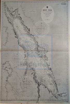
Part of CARTAS NÁUTICAS
Zona Geográfica: Mar Rojo
Aparecen a la izquierda las costas de Sudán, Abysinia, Egipto y Nubia; a la derecha las costas de Yemen, en la península Arábiga.
INSTITUTO HIDROGRÁFICO INGLATERRA
RIVER BENIN TO RIVER CAMEROONS INCLUDING THE MOUTHS OF THE RIVER KWARA OR NIGER
Part of CARTAS NÁUTICAS
Zona Geográfica: Costa oeste de África
Aparecen las tierras de Benin y de Camerún; isla de Fernando Poo.
INSTITUTO HIDROGRÁFICO INGLATERRA
Part of CARTAS NÁUTICAS
Zona Geográfica: Mar del Norte. Alemania
Curso del río Ems con las islas de Borkum, Rottumeroog y otras. Aparecen las ciudad de Delfzijl, Emden y Norden.
INSTITUTO HIDROGRÁFICO INGLATERRA
Part of CARTAS NÁUTICAS
Zona Geográfica: Costa Oeste de África. Gambia
Costa de África correspondiente con la entrada del río Gambia.
INSTITUTO HIDROGRÁFICO INGLATERRA
RIVER GAMBIA TO CAPE LOPEZ AND ANNOBON
Part of CARTAS NÁUTICAS
Zona Geográfica: Costa de Guinea. África Costa Occidental
Plano de la costa oeste de África que va desde el río Gambia hasta Annobon y el cabo López con una parte de la ensenada de Biafra y Benín. Costas de Senegal, Guinea Portuguesa, Guinea Francesa, Sierra Leona, Liberia...
INSTITUTO HIDROGRÁFICO INGLATERRA
Part of CARTAS NÁUTICAS
Zona Geográfica: Costa Este de Inglaterra
Entrada del río Tyne, dejando al norte Tynemouth y Northshields y al sur SouthShields.
INSTITUTO HIDROGRÁFICO INGLATERRA
Part of CARTAS NÁUTICAS
Zona Geográfica: Costa este de Inglaterra
Tierras de Northumberland, mar del Norte y el río Tyne
INSTITUTO HIDROGRÁFICO INGLATERRA