GRAN BEREBI TO CAPE THREE POINTS
Add to clipboard
Zona Geográfica: Costa oeste de África
INSTITUTO HIDROGRÁFICO INGLATERRA
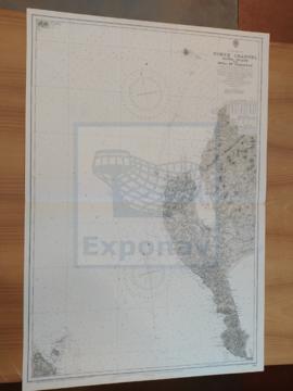
TEES BAY
Add to clipboard
Zona Geográfica: Costa este de Inglaterra
INSTITUTO HIDROGRÁFICO INGLATERRA
FAEROE ISLANDS TO NORWAY
Add to clipboard
Zona Geográfica: Atlántico norte
INSTITUTO HIDROGRÁFICO INGLATERRA
FIRTH OF SOLWAY
Add to clipboard
Zona Geográfica: Costa oeste de Inglaterra
INSTITUTO HIDROGRÁFICO INGLATERRA
ENGLISH CHANNEL. EASTERN PORTION
Add to clipboard
Zona Geográfica: Canal de la Mancha
INSTITUTO HIDROGRÁFICO INGLATERRA
ENGLISH CHANNEL. WESTERN PORTION
Add to clipboard
Zona Geográfica: Canal de la Mancha
INSTITUTO HIDROGRÁFICO INGLATERRA
ISLAND OF ISLAY
Add to clipboard
Zona Geográfica: Costa oeste de Escocia
INSTITUTO HIDROGRÁFICO INGLATERRA
NEW PROVIDENCE ISLAND. BAHAMAS ISLANDS
Add to clipboard
Zona Geográfica: Indias Occidentales. Islas Bahamas
INSTITUTO HIDROGRÁFICO INGLATERRA