ISLAND OF LINNEY HEAD TO OXWICH POINT
Add to clipboard
Zona Geográfica: Costa sur de Gales
INSTITUTO HIDROGRÁFICO INGLATERRA
THE GREENLAND AND BARENTS SEAS
Add to clipboard
Zona Geográfica: Océano Ártico
INSTITUTO HIDROGRÁFICO INGLATERRA
SOUTH ATLANTIC OCEAN
Add to clipboard
Zona Geográfica: Océano Atlántico sureste
INSTITUTO HIDROGRÁFICO INGLATERRA
THE NORTH SEA
Add to clipboard
Zona Geográfica: Mar del Norte
INSTITUTO HIDROGRÁFICO INGLATERRA
HARTLEPOOL TO BLYTH
Add to clipboard
Zona Geográfica: Costa este de Inglaterra
INSTITUTO HIDROGRÁFICO INGLATERRA
CAPE ST. ANN TO CAPE THREE POINTS
Add to clipboard
Zona Geográfica: Costa oeste de África
INSTITUTO HIDROGRÁFICO INGLATERRA
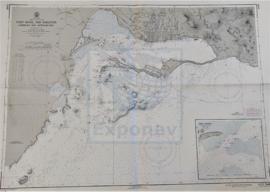
PORT ROYAL AND KINGSTON HARBORS AND APPROACHES
Add to clipboard
Zona Geográfica: Costa sur de Jamaica. Indias Occidentales
INSTITUTO HIDROGRÁFICO INGLATERRA

