CABLE DE MAL TIEMPO Add to clipboard ES EXPONAV ASTANO-CARG-SERIE N-748 Stuk 1964 Part of ASTANO ASTANO
CABLE DE MAL TIEMPO Add to clipboard ES EXPONAV ASTANO-CARG-SERIE Ñ-109 Stuk 1967 Part of ASTANO ASTANO
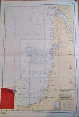
CABO MACHICHACO A RÍO GIRONDA Add to clipboard ES EXPONAV CARTAS NÁUTICAS CCN-000017 Stuk 1952 Part of CARTAS NÁUTICAS Zona Geográfica: Costa oriental España/FranciaDescripción de la costa cantábrica de la zona norte del País Vasco y zona oeste de Francia, con los ríos y puertos más importantes de la zona. INSTITUTO HIDROGRÁFICO ESPAÑA
CABRESTANTE VERTICAL Add to clipboard ES EXPONAV ASTANO-CARG-SERIE A-218 Stuk 1961 Part of ASTANO ASTANO
CABRIA DE 30 TONELADAS Add to clipboard ES EXPONAV ASTANO-CABR.30T Deelarchief 2020 Part of ASTANO ASTANO
CABRIA DE POPA EN CUBIERTA TOLDILLA Add to clipboard ES EXPONAV ASTANO-BAC-SERIE A-201 Stuk Part of ASTANO ASTANO
CABRIAS DE PESCA. CONJUNTO Y DETALLES Add to clipboard ES EXPONAV ASTANO-PESQ-SERIE U-191 Stuk Part of ASTANO ASTANO
CABRIAS DE PESCA. CONJUNTO Y DETALLES Add to clipboard ES EXPONAV ASTANO-PESQ-SERIE U-191 Stuk Part of ASTANO ASTANO
CACHEO RIVER TO ILES DE LOS Add to clipboard ES EXPONAV CARTAS NÁUTICAS CCN-000047 Stuk 1826 Part of CARTAS NÁUTICAS Zona Geográfica: Costa Oeste de ÁfricaCosta desde el río Cacheo hasta lIes de Los. Islas Bissagos y Canal de Orango INSTITUTO HIDROGRÁFICO INGLATERRA