CAYO GRANDE PAREDON TO PUNTA MATERNILLOS
Añadir al portapapeles
ES EXPONAV CARTAS NÁUTICAS CCN-000299
Unidad documental simple
1929
Parte deCARTAS NÁUTICAS
Zona Geográfica: Costa norte de Cuba. Indias Occidentales
INSTITUTO HIDROGRÁFICO ESTADOS UNIDOS DE AMÉRICA
ISLAND OF LINNEY HEAD TO OXWICH POINT
Añadir al portapapeles
ES EXPONAV CARTAS NÁUTICAS CCN-000188
Unidad documental simple
1954
Parte deCARTAS NÁUTICAS
Zona Geográfica: Costa sur de Gales
INSTITUTO HIDROGRÁFICO INGLATERRA
BAHIAS NIPE, LEVISA AND CABONICO
Añadir al portapapeles
ES EXPONAV CARTAS NÁUTICAS CCN-000298
Unidad documental simple
1932
Parte deCARTAS NÁUTICAS
Zona Geográfica: Costa norte de Cuba. Indias Occidentales
INSTITUTO HIDROGRÁFICO ESTADOS UNIDOS DE AMÉRICA
ISLAND OF CORSICA
Añadir al portapapeles
ES EXPONAV CARTAS NÁUTICAS CCN-000187
Unidad documental simple
1824
Parte deCARTAS NÁUTICAS
Zona Geográfica: Mar Mediterráneo
INSTITUTO HIDROGRÁFICO FRANCIA
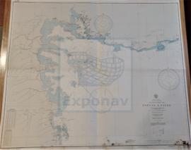
GUADELOUPE APPROACHES TO POINTE À PITRE
Añadir al portapapeles
ES EXPONAV CARTAS NÁUTICAS CCN-000297
Unidad documental simple
1867
Parte deCARTAS NÁUTICAS
Zona Geográfica: Guadalupe. Indias Occidentales
INSTITUTO HIDROGRÁFICO FRANCIA
GUADELOUPE APPROACHES TO POINTE À PITRE
Añadir al portapapeles
ES EXPONAV CARTAS NÁUTICAS CCN-000297
Unidad documental simple
1867
Parte deCARTAS NÁUTICAS
Zona Geográfica: Guadalupe. Indias Occidentales
INSTITUTO HIDROGRÁFICO FRANCIA
RIVER TYNE TO ST. ABBS HEAD
Añadir al portapapeles
ES EXPONAV CARTAS NÁUTICAS CCN-000185
Unidad documental simple
1932
Parte deCARTAS NÁUTICAS
Zona Geográfica: Costa este de Inglaterra
INSTITUTO HIDROGRÁFICO INGLATERRA
YUCATAN CHANNEL AND APPROACHES
Añadir al portapapeles
ES EXPONAV CARTAS NÁUTICAS CCN-000296
Unidad documental simple
1929
Parte deCARTAS NÁUTICAS
Zona Geográfica: Norte América
INSTITUTO HIDROGRÁFICO ESTADOS UNIDOS DE AMÉRICA
PUERTO GIBARA TO CAYO MOA GRANDE
Añadir al portapapeles
ES EXPONAV CARTAS NÁUTICAS CCN-000295
Unidad documental simple
1899
Parte deCARTAS NÁUTICAS
Zona Geográfica: Costa norte de Cuba. Indias Occidentales
INSTITUTO HIDROGRÁFICO ESTADOS UNIDOS DE AMÉRICA