KILBRANNAN SOUND AND APPROACHES
- ES EXPONAV CARTAS NÁUTICAS CCN-000180
- Item
- 1947
Part of CARTAS NÁUTICAS
Zona Geográfica: Costa oeste de Escocia
Aparece la península de Kintyre y la isla de Arran
INSTITUTO HIDROGRÁFICO INGLATERRA
9 results with digital objects Show results with digital objects
KILBRANNAN SOUND AND APPROACHES
Part of CARTAS NÁUTICAS
Zona Geográfica: Costa oeste de Escocia
Aparece la península de Kintyre y la isla de Arran
INSTITUTO HIDROGRÁFICO INGLATERRA
Part of CARTAS NÁUTICAS
Zona Geográfica: Costa sur de Inglaterra
Aparecen las tierras de Hampshire, Sussex y la isla de Wight
INSTITUTO HIDROGRÁFICO INGLATERRA
ISLAND OF LINNEY HEAD TO OXWICH POINT
Part of CARTAS NÁUTICAS
Zona Geográfica: Costa sur de Gales
Aparecen las tierras de Pembrokeshire y Carmarthenshire. Bahía de Carmarthen
INSTITUTO HIDROGRÁFICO INGLATERRA
ARDNAMURCHAN TO SUMMER ISLES INCLUDING THE INNER CHANNEL AND THE MINCH
Part of CARTAS NÁUTICAS
Zona Geográfica: Costa oeste de Escocia
Aparece la isla de Skye, la costa de Inverness, Ross, Cromarty, Harris y Lewis
INSTITUTO HIDROGRÁFICO INGLATERRA
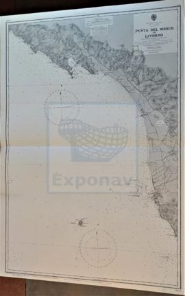
Part of CARTAS NÁUTICAS
Zona Geográfica: Costa oeste de Italia. Mar Mediterráneo
Ciudades de Spezi y Livorno. Isla Gorgona
INSTITUTO HIDROGRÁFICO ITALIA
NORTH CHANNEL. MULL OF KINTYRE TO BELFAST LOUGH
Part of CARTAS NÁUTICAS
Zona Geográfica: Costa este de Irlanda
Aparece el Canal del Norte, costa del condado de Antrim
INSTITUTO HIDROGRÁFICO INGLATERRA
Part of CARTAS NÁUTICAS
Zona Geográfica: África del norte. Mar Mediterráneo
Desde la punta Kef el Assfer al cabo Tenes.
Incluye una vista de la costa
INSTITUTO HIDROGRÁFICO FRANCIA
Part of CARTAS NÁUTICAS
Zona Geográfica: Costa este de Inglaterra
Aparecen las ciudades de Blyth, Tynemouth, Sunderland, Seaham Harbour y Hartlepool
INSTITUTO HIDROGRÁFICO INGLATERRA