- ES EXPONAV CARTAS NÁUTICAS CCN-000192
- Item
- 1912
Part of CARTAS NÁUTICAS
Zona Geográfica: Costa este de Inglaterra
Contiene las tierras de Yorkshire, Lincolnshire y Norfolk
INSTITUTO HIDROGRÁFICO INGLATERRA
18 results with digital objects Show results with digital objects
Part of CARTAS NÁUTICAS
Zona Geográfica: Costa este de Inglaterra
Contiene las tierras de Yorkshire, Lincolnshire y Norfolk
INSTITUTO HIDROGRÁFICO INGLATERRA
Part of CARTAS NÁUTICAS
Zona Geográfica: Islas británicas
Islas Shetland (Mainland, Yell y Unst)
INSTITUTO HIDROGRÁFICO INGLATERRA
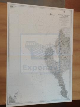
NORTH CHANNEL. SANDA ISLANS TO MULL OF GALLOWAY
Part of CARTAS NÁUTICAS
Zona Geográfica: Costa oeste de Escocia
Aparece el Canal del Norte, parte de la costa de Irlanda y Therinns en la isla Sanda
INSTITUTO HIDROGRÁFICO INGLATERRA
Part of CARTAS NÁUTICAS
Zona Geográfica: Atlántico norte
Aparece la costa de Noruega y las islas Feroe
INSTITUTO HIDROGRÁFICO INGLATERRA
ENGLISH CHANNEL. EASTERN PORTION
Part of CARTAS NÁUTICAS
Zona Geográfica: Canal de la Mancha
Aparece el Canal de la Mancha separando Inglaterra y Francia
INSTITUTO HIDROGRÁFICO INGLATERRA
ENGLISH CHANNEL. WESTERN PORTION
Part of CARTAS NÁUTICAS
Zona Geográfica: Canal de la Mancha
Canal de la Mancha separando el sur de Inglaterra de Francia
INSTITUTO HIDROGRÁFICO INGLATERRA
ENGLISH CHANNEL. WESTERN SHEET. MILFORD HAVEN TO PLYMOUTH
Part of CARTAS NÁUTICAS
Zona Geográfica: Canal de la Mancha
Aparece las tierras de Pembroke y Cornwall
INSTITUTO HIDROGRÁFICO INGLATERRA
Part of CARTAS NÁUTICAS
Zona Geográfica: Costa sur de Irlanda
Zona del puerto de Cork y sus alrededores. Aparecen Great Island, Little Island y Foaty Island.
INSTITUTO HIDROGRÁFICO INGLATERRA
Part of CARTAS NÁUTICAS
Zona Geográfica: Mar del Norte
Zona del Mar del Norte entre Inglaterra, Alemania, Países Bajos y parte de Francia.
INSTITUTO HIDROGRÁFICO INGLATERRA
CAPE GHIR TO GARNET HEAD INCLUDING THE CANARY ISLANDS
Part of CARTAS NÁUTICAS
Zona Geográfica: Costa Oeste de África
Costa de África que va desde el cabo Ghir hasta Garnet Head. Aparecen las islas Canarias.
INSTITUTO HIDROGRÁFICO INGLATERRA