- ES EXPONAV CARTAS NÁUTICAS CCN-000128
- Item
- 1863
Part of CARTAS NÁUTICAS
Zona Geográfica: Sureste de Escocia. Islas Hébridas
Aparecen las islas de Ornish y Shillay More.
INSTITUTO HIDROGRÁFICO INGLATERRA
5 results with digital objects Show results with digital objects
Part of CARTAS NÁUTICAS
Zona Geográfica: Sureste de Escocia. Islas Hébridas
Aparecen las islas de Ornish y Shillay More.
INSTITUTO HIDROGRÁFICO INGLATERRA
LOCHS ERISORT, LEURBOST AND GRIMSHADER
Part of CARTAS NÁUTICAS
Zona Geográfica: Costa oeste de Escocia
Contiene un recuadro con el lago Erisort y las entradas a Leurbost y Erisort
INSTITUTO HIDROGRÁFICO INGLATERRA
PLANS ON THE SOUTH COAST OF WALES
Part of CARTAS NÁUTICAS
Zona Geográfica: Islas Británicas
Aparece la bahía de Swansea y los alrededores de Porthcawl
INSTITUTO HIDROGRÁFICO INGLATERRA
Part of CARTAS NÁUTICAS
Zona Geográfica: Costa oeste de Escocia. Islas Hébridas
Contiene los canales de Scalpay y Braich More. Aparecen las islas de Scalpay, Scotasay, Glorigs, Rossay.
INSTITUTO HIDROGRÁFICO INGLATERRA
Part of CARTAS NÁUTICAS
Zona Geográfica: Costa sur de Irlanda
Aparece Great Island, Spike island y Haulbowline island
INSTITUTO HIDROGRÁFICO INGLATERRA
Part of CARTAS NÁUTICAS
Zona Geográfica: Costa oeste de Inglaterra- Bahía de Morecambe
Aparece el puerto de Barrow
INSTITUTO HIDROGRÁFICO INGLATERRA
Part of CARTAS NÁUTICAS
Zona Geográfica: Costa este de Inglaterra
Aparece la bahía de Tees y el puente Victoria a la misma escala
INSTITUTO HIDROGRÁFICO INGLATERRA
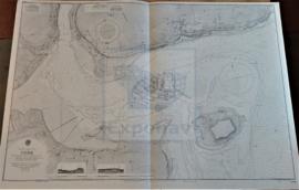
THE NARROWS AND ST. GEORGE´S HARBOUR
Part of CARTAS NÁUTICAS
Zona Geográfica: Océano Atlántico norte. Islas Bermudas
Islas de St. George, Smith y David
INSTITUTO HIDROGRÁFICO INGLATERRA
HARBOURS AND ANCHORAGES ON THE COAST OF HAITI AND THE DOMINICAN REPUBLIC
Part of CARTAS NÁUTICAS
Zona Geográfica: Mar Caribe
Contiene 11 recuadros con St. Nicolás Mole a 1:25000; Cayemites Bay a 1:147410; Navassa Island a 1:23280; Acul Bay a 1:53000; Romana River entrance a 1:12500; Gran Pierre Bay a 1:50000; Port Jackson a 1:25180; St. Marc Bay a 1:36640; Jacmel Bay a 1:29150; Port Plata a 1:10100 y Puerto de la ciudad de Trujillo a 1:13130
INSTITUTO HIDROGRÁFICO ESTADOS UNIDOS DE AMÉRICA
Part of CARTAS NÁUTICAS
Zona Geográfica: Costa oeste de Italia. Mar Mediterráneo
Aparece el puerto de Nápoles y calles adyacentes
INSTITUTO HIDROGRÁFICO ITALIA