Mostrando 38 resultados

Descripción archivística
CARTAS NÁUTICAS portulano
Opciones avanzadas de búsqueda
Imprimir vista previa Ver :

5 resultados con objetos digitales Muestra los resultados con objetos digitales

PORTS AND ANCHORAGES IN YUGOSLAVIA

  • ES EXPONAV CARTAS NÁUTICAS CCN-000237
  • Unidad documental simple
  • 1950
  • Parte deCARTAS NÁUTICAS

Zona Geográfica: Mar Mediterráneo. Mar Adriático
Carta dividida en 10 recuadros: Luka Ploce a 1:12000; Luka Polace a 1:24000; Zaliv Klek Neum a 1:36000; Usce Neretve a 1:36000; Luka Pomina a 1:36000; Kanal Malog Stona a 1:36000; Luka Zaton a 1:24000; Luka Slano a 1:24000; Luka Gruz a 1:24000 y Dubrovnick a 1:36000.

INSTITUTO HIDROGRÁFICO YUGOSLAVIA

NIQUERO BAY AND APPROACHES

  • ES EXPONAV CARTAS NÁUTICAS CCN-000241
  • Unidad documental simple
  • 1907
  • Parte deCARTAS NÁUTICAS

Zona Geográfica: Costa sur de Cuba. Indias Occidentales
Aparece la bahía de Niquero. Contiene un recuadro con las cercanías a Beliz incluyendo la bahía Guanito y el río Limones a escala 1:24321

INSTITUTO HIDROGRÁFICO ESTADOS UNIDOS DE AMÉRICA

PUERTO MATANZAS

  • ES EXPONAV CARTAS NÁUTICAS CCN-000245
  • Unidad documental simple
  • 1925
  • Parte deCARTAS NÁUTICAS

Zona Geográfica: Costa norte de Cuba. Indias Occidentales
Aparece el puerto de Matanzas y el valle de Yumuri

INSTITUTO HIDROGRÁFICO ESTADOS UNIDOS DE AMÉRICA

ANCHORAGES ON THE WEST COAST OF ÁFRICA

  • ES EXPONAV CARTAS NÁUTICAS CCN-000247
  • Unidad documental simple
  • 1875
  • Parte deCARTAS NÁUTICAS

Zona Geográfica: Costa oeste de África. Senegal
Contiene 4 recuadros: Rufisque Anchorage (Senegal) a 1:20000 (1875-1876); Portudal Anchorage (Senegal) a 1:30000 (1843); Dakar Road (Senegal) a 1:20000 (1930) y Joal Anchorage (Senegal) a 1:30000 (1910)

INSTITUTO HIDROGRÁFICO FRANCIA

BAIE DE FORT DE FRANCE

  • ES EXPONAV CARTAS NÁUTICAS CCN-000256
  • Unidad documental simple
  • 1824
  • Parte deCARTAS NÁUTICAS

Zona Geográfica: Martinica. Indias Occidentales.
Aparece la bahía y el puerto de Fort de France

INSTITUTO HIDROGRÁFICO FRANCIA

HARBOUR OF ST. THOMAS

  • ES EXPONAV CARTAS NÁUTICAS CCN-000258
  • Unidad documental simple
  • 1918
  • Parte deCARTAS NÁUTICAS

Zona Geográfica: Indias Occidentales
Isla de St. Thomas con la ciudad de Charlotte Amalie. Aparecen las islas Hassel y Water

INSTITUTO HIDROGRÁFICO ESTADOS UNIDOS DE AMÉRICA

APPROACHES TO MANZANILLO

  • ES EXPONAV CARTAS NÁUTICAS CCN-000269
  • Unidad documental simple
  • 1908
  • Parte deCARTAS NÁUTICAS

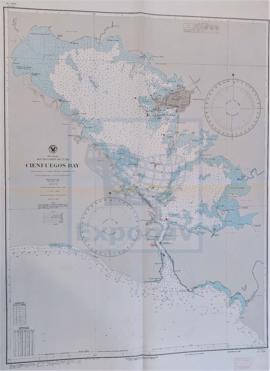
Zona Geográfica: Costa sur de Cuba. Indias Occidentales
Aparecen los cayos de Manzanillo (cayo Largo, cayo Grande, cayo Gua, cayo Blanco), la ciudad de Manzanillo y la bahía Caimanera

INSTITUTO HIDROGRÁFICO ESTADOS UNIDOS DE AMÉRICA

ENTRANCE TO CIENFUEGOS BAY

  • ES EXPONAV CARTAS NÁUTICAS CCN-000271
  • Unidad documental simple
  • 1902
  • Parte deCARTAS NÁUTICAS

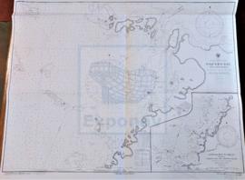
Zona Geográfica: Costa sur de Cuba. Indias Occidentales
Aparecen el cayo de Carenas, punta de Pasacaballos, punta de la Sabanilla y punta de los Colorados

INSTITUTO HIDROGRÁFICO ESTADOS UNIDOS DE AMÉRICA

CIENFUEGOS HARBOR

  • ES EXPONAV CARTAS NÁUTICAS CCN-000272
  • Unidad documental simple
  • 1902
  • Parte deCARTAS NÁUTICAS

Zona Geográfica: Costa sur de Cuba. Indias Occidentales
Aparece el puerto de Cienfuegos y las ensenadas de Ramírez y Marsillan

INSTITUTO HIDROGRÁFICO ESTADOS UNIDOS DE AMÉRICA

CIENFUEGOS BAY

  • ES EXPONAV CARTAS NÁUTICAS CCN-000273
  • Unidad documental simple
  • 1902
  • Parte deCARTAS NÁUTICAS

Zona Geográfica: Costa sur de Cuba. Indias Occidentales
Aparece la ciudad y la bahía de Cienfuegos

INSTITUTO HIDROGRÁFICO ESTADOS UNIDOS DE AMÉRICA

Resultados 21 a 30 de 38