Este sitio web utiliza cookies para mejorar su experiencia para navegar y cargar contenido. Más Información.
zoeken
To begin your search, type the term you wish to find in the search engine at the top of the page, and click ‘advanced search’ if necessary.
We've redirected you to the first page of results. To avoid using vast amounts of memory, AtoM limits pagination to 10,000 records. To view the last records in the current result set, try changing the sort direction.
Zona Geográfica: Costa Oeste de África. Liberia Costa de África desde la bahía de Cestos hasta Gran Butu. Aparecen los ríos Sangwin y Poa, montañas y ciudades de Liberia.
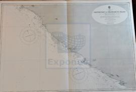
Zona Geográfica: Océano Atlántico Norte Archipiélago de Cabo Verde, formado por las islas de Brava, Fuego, Santiago, Maio, Buena Vista, Sal, San Nicolás, Santa Lucía, San Vicente y San Antonio.
Zona Geográfica: Islas de las Indias Occidentales Islas y bancos entre San Salvador y Santo Domingo: Turks islands, Great Inagua, Mayaguana, Acklins island. Parte de las islas de Cuba y Haití.