- ES EXPONAV CARTAS NÁUTICAS CCN-000059
- Item
- 1888
Part of CARTAS NÁUTICAS
Zona Geográfica: Costa sur de Irlanda
Plano de la ciudad de Queenstown y el puerto de Cork
INSTITUTO HIDROGRÁFICO INGLATERRA
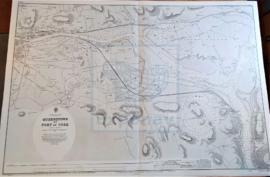
Part of CARTAS NÁUTICAS
Zona Geográfica: Costa sur de Irlanda
Plano de la ciudad de Queenstown y el puerto de Cork
INSTITUTO HIDROGRÁFICO INGLATERRA
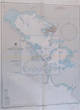
Part of CARTAS NÁUTICAS
Zona Geográfica: Costa sur de Cuba. Indias Occidentales
Aparece la ciudad y la bahía de Cienfuegos
INSTITUTO HIDROGRÁFICO ESTADOS UNIDOS DE AMÉRICA

PORT ROYAL AND KINGSTON HARBORS AND APPROACHES
Part of CARTAS NÁUTICAS
Zona Geográfica: Costa sur de Jamaica. Indias Occidentales
Ciudad y puerto de Kingston. Incluye un recuadro con Ship Channel a escala 1:12500
INSTITUTO HIDROGRÁFICO INGLATERRA
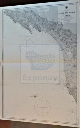
Part of CARTAS NÁUTICAS
Zona Geográfica: Costa oeste de Italia. Mar Mediterráneo
Ciudades de Spezi y Livorno. Isla Gorgona
INSTITUTO HIDROGRÁFICO ITALIA