- ES EXPONAV CARTAS NÁUTICAS CCN-000086
- Stuk
- 1835
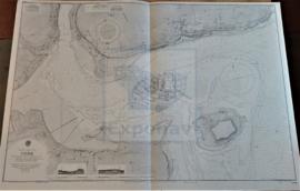
Part of CARTAS NÁUTICAS
Zona Geográfica: Costa Oeste de Inglaterra
Costa de Inglaterra desde la isla de Holyhead hasta Lade Great Ormes
INSTITUTO HIDROGRÁFICO INGLATERRA
18 results with digital objects Show results with digital objects
Part of CARTAS NÁUTICAS
Zona Geográfica: Costa Oeste de Inglaterra
Costa de Inglaterra desde la isla de Holyhead hasta Lade Great Ormes
INSTITUTO HIDROGRÁFICO INGLATERRA
Part of CARTAS NÁUTICAS
Zona Geográfica: Costa oeste de Inglaterra- Bahía de Morecambe
Aparece el puerto de Barrow
INSTITUTO HIDROGRÁFICO INGLATERRA
Part of CARTAS NÁUTICAS
Zona Geográfica: Costa sur de Irlanda
Aparece Great Island, Spike island y Haulbowline island
INSTITUTO HIDROGRÁFICO INGLATERRA
Part of CARTAS NÁUTICAS
Zona Geográfica: África costa oeste
Desde cabo Mesurado hasta la punta Baffu, con las bahías de Mesurado, Cestos y Baffu. Entrada al puerto de Monrovia.
INSTITUTO HIDROGRÁFICO INGLATERRA
Part of CARTAS NÁUTICAS
Zona Geográfica: Costa Oeste de África. Liberia
Costa de África en la zona de Liberia desde el río Junk hasta la bahía de Cestos. Aparecen los montes Tobacco y Table. Contiene un recuadro con la bahía de Gran Bassa.
INSTITUTO HIDROGRÁFICO INGLATERRA
BAFFU BAY TO GRAND BEREBI INCLUDING CAPE PALMAS
Part of CARTAS NÁUTICAS
Zona Geográfica: Costa oeste de África
Tierras de Liberia y costa de Ivory
INSTITUTO HIDROGRÁFICO INGLATERRA
Part of CARTAS NÁUTICAS
Zona Geográfica: Egipto. Mar Mediterráneo
Aparecen las ciudades de Damietta y Al 'Arish. Lago Manzala
INSTITUTO HIDROGRÁFICO INGLATERRA
BARRY & WATCHET TO NEWPORT & WESTON-SUPER-MARE
Part of CARTAS NÁUTICAS
Zona Geográfica: Costa oeste de Inglaterra. Canal de Bristol
Aparecen las ciudades de Newport, Penarth, Cardiff y Weston-super-mare. Las bahías de Bridgwater y de Cueston.
INSTITUTO HIDROGRÁFICO INGLATERRA

SIYAL ISLAND TO MASAMIRIT ISLET
Part of CARTAS NÁUTICAS
Zona Geográfica: Mar Rojo
Aparecen las tierras de Arabia Saudí y Sudán.
Incluye recuadros con: Marsa Halaka a 1:36940; Khor Shin'ab a 1:72980; Marsa Arakiyai a 1:36830; Al Lith a 1:72000; Al Qunfidha a 1:72060 y Jalajil a 1:90500
INSTITUTO HIDROGRÁFICO INGLATERRA
CAPE SIERRA LEONO TO TURTLE ISLANDS
Part of CARTAS NÁUTICAS
Zona Geográfica: Costa oeste de África
Proximidades de Sierra Leona y Sherbo. Puerto de Freetown y las islas Banana y Tortuga
INSTITUTO HIDROGRÁFICO INGLATERRA