Mostrando 46 resultados

Descripción archivística
CARTAS NÁUTICAS CARTA DE APROXIMACIÓN
Opciones avanzadas de búsqueda
Imprimir vista previa Ver :

7 resultados con objetos digitales Muestra los resultados con objetos digitales

ANCHORAGES ON THE WEST COAST OF ÁFRICA

  • ES EXPONAV CARTAS NÁUTICAS CCN-000247
  • Unidad documental simple
  • 1875
  • Parte deCARTAS NÁUTICAS

Zona Geográfica: Costa oeste de África. Senegal
Contiene 4 recuadros: Rufisque Anchorage (Senegal) a 1:20000 (1875-1876); Portudal Anchorage (Senegal) a 1:30000 (1843); Dakar Road (Senegal) a 1:20000 (1930) y Joal Anchorage (Senegal) a 1:30000 (1910)

INSTITUTO HIDROGRÁFICO FRANCIA

PORT ROYAL AND KINGSTON HARBORS AND APPROACHES

  • ES EXPONAV CARTAS NÁUTICAS CCN-000248
  • Unidad documental simple
  • 1956
  • Parte deCARTAS NÁUTICAS

Zona Geográfica: Costa sur de Jamaica. Indias Occidentales
Ciudad y puerto de Kingston. Incluye un recuadro con Ship Channel a escala 1:12500

INSTITUTO HIDROGRÁFICO INGLATERRA

ISLANDS IN THE SOUTHERN PORTION OF THE RED SEA

  • ES EXPONAV CARTAS NÁUTICAS CCN-000249
  • Unidad documental simple
  • 1881
  • Parte deCARTAS NÁUTICAS

Zona Geográfica: Mar Rojo
Contiene 3 recuadros con: Zubair island a escala 1:96800; Zuqar island y Hanish islands a escala 1: 96600 y Abu'Ali Channel a escala 1:36950

INSTITUTO HIDROGRÁFICO INGLATERRA

ISLAND OF MARTINIQUE

  • ES EXPONAV CARTAS NÁUTICAS CCN-000251
  • Unidad documental simple
  • 1824
  • Parte deCARTAS NÁUTICAS

Zona Geográfica: Indias Occidentales
Aparece la isla Martinica

INSTITUTO HIDROGRÁFICO FRANCIA

PLANS IN THE NETHERLANDS

  • ES EXPONAV CARTAS NÁUTICAS CCN-000253
  • Unidad documental simple
  • 1947
  • Parte deCARTAS NÁUTICAS

Zona Geográfica: Mar del Norte
Dividido en dos recuadros que incluyen Zeegat van Texel a escala 1:50000 (1954) y Ijmuiden Habor a escala 1:12500 (1947)

INSTITUTO HIDROGRÁFICO PAÍSES BAJOS

NEW PROVIDENCE ISLAND. BAHAMAS ISLANDS

  • ES EXPONAV CARTAS NÁUTICAS CCN-000257
  • Unidad documental simple
  • 1881
  • Parte deCARTAS NÁUTICAS

Zona Geográfica: Indias Occidentales. Islas Bahamas
Aparece la isla de New Providence, el lago Killarney y la isla de Hog

INSTITUTO HIDROGRÁFICO INGLATERRA

DRY TORTUGAS

  • ES EXPONAV CARTAS NÁUTICAS CCN-000279
  • Unidad documental simple
  • 1927
  • Parte deCARTAS NÁUTICAS

Zona Geográfica: Florida. Estados Unidos de América
Aparece Loggerhead Key, Garden Key y East Key.
Contiene un recuadro con el Puerto de Tortugas a escala 1: 10000

INSTITUTO HIDROGRÁFICO ESTADOS UNIDOS DE AMÉRICA

PORTS CASILDA AND MASIO AND APPROACHES

  • ES EXPONAV CARTAS NÁUTICAS CCN-000288
  • Unidad documental simple
  • 1915
  • Parte deCARTAS NÁUTICAS

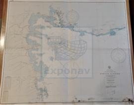
Zona Geográfica: Costa sur de Cuba. Indias Occidentales
Aparece la ciudad de Casilda, las bahías Caballones y San Pedro, puerto Masio, cayo Blanco y el río Manati

INSTITUTO HIDROGRÁFICO ESTADOS UNIDOS DE AMÉRICA

GUADELOUPE APPROACHES TO POINTE À PITRE

  • ES EXPONAV CARTAS NÁUTICAS CCN-000297
  • Unidad documental simple
  • 1867
  • Parte deCARTAS NÁUTICAS

Zona Geográfica: Guadalupe. Indias Occidentales
Aparece la ciudad de Pointre à Pitre y Petit Cul de Sac Marin

INSTITUTO HIDROGRÁFICO FRANCIA

GUADELOUPE APPROACHES TO POINTE À PITRE

  • ES EXPONAV CARTAS NÁUTICAS CCN-000297
  • Unidad documental simple
  • 1867
  • Parte deCARTAS NÁUTICAS

Zona Geográfica: Guadalupe. Indias Occidentales
Aparece la ciudad de Pointre à Pitre y Petit Cul de Sac Marin

INSTITUTO HIDROGRÁFICO FRANCIA

Resultados 31 a 40 de 46