- ES EXPONAV CARTAS NÁUTICAS CCN-000319
- Stuk
- 1867
Part of CARTAS NÁUTICAS
Zona Geográfica: Entre Argelia y Cherchel. Mar Mediterráneo
Aparece la llanura de Mitidja y las ciudades de Argel y Cherchel
INSTITUTO HIDROGRÁFICO FRANCIA
1 results with digital objects Show results with digital objects
Part of CARTAS NÁUTICAS
Zona Geográfica: Entre Argelia y Cherchel. Mar Mediterráneo
Aparece la llanura de Mitidja y las ciudades de Argel y Cherchel
INSTITUTO HIDROGRÁFICO FRANCIA
Part of CARTAS NÁUTICAS
Zona Geográfica: Egipto. Mar Mediterráneo
Costa de Egipto desde Port Said hasta Alejandría con la bahía de Aboukir, las entradas de Rosette y Damiette
INSTITUTO HIDROGRÁFICO FRANCIA
Part of CARTAS NÁUTICAS
Zona Geográfica: Costa de Argelia. Mar Mediterráneo
Portulano del puerto de Argel.
Incluye un recuadro de Mouillage de la Pointe Pescade
INSTITUTO HIDROGRÁFICO FRANCIA
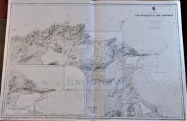
DU CAP FERRAT À LA POINTE KEF EL ASFER
Part of CARTAS NÁUTICAS
Zona Geográfica: Costa de Argelia. Mar Mediterráneo
Golfo de d'Arzeu, ciudad de Arzeu, Mostaganem.
INSTITUTO HIDROGRÁFICO FRANCIA
Part of CARTAS NÁUTICAS
Zona Geográfica: Costa de Algeria. Mar Mediterráneo
Aparece la ciudad de Oran, cabo Falcon, bahía de Canastel y cabo de l'Aiguille.
Contiene un recuadro con la bahía de los Andaluces (1931)
INSTITUTO HIDROGRÁFICO FRANCIA
Part of CARTAS NÁUTICAS
Zona Geográfica: Mar Mediterráneo. Costa norte de Túnez
Aparece la costa tunecina con los lagos de Lishkoel, Bizerte y Porto Farina y el golfo de Túnez.
INSTITUTO HIDROGRÁFICO FRANCIA
Part of CARTAS NÁUTICAS
Zona Geográfica: Costa sur de Francia. Mar Mediterráneo
Aparece la ciudad de Marsella y el golfo de Fos.
Incluye un recuadro con el puerto de Bouc a escala 1:29160
INSTITUTO HIDROGRÁFICO FRANCIA
Part of CARTAS NÁUTICAS
Zona Geográfica: Mar Mediterráneo
Isla de Córcega
INSTITUTO HIDROGRÁFICO FRANCIA
C. BOUGARONI TO FRATELLI ROCKS INCLUDING THE GALITA CHANNEL
Part of CARTAS NÁUTICAS
Zona Geográfica: Mar Mediterráneo. Túnez. Argelia
Costa de Argelia desde Ras Atia hasta Ras Engelo con unos planos insertos de los puertos de Tabarka. Incluye la isla de la Galite
INSTITUTO HIDROGRÁFICO FRANCIA
Part of CARTAS NÁUTICAS
Zona Geográfica: Costa de Argelia. Mar Mediterráneo
Proximidades del puerto de Bougie con los cabos de Carbon, Noir y Bouak
INSTITUTO HIDROGRÁFICO FRANCIA