Affichage de 17 résultats

Description archivistique
INSTITUTO HIDROGRÁFICO INGLATERRA MAR MEDITERRÁNEO
Options de recherche avancée
Aperçu avant impression Affichage :

4 résultats avec objets numériques Afficher les résultats avec des objets numériques

SUSA TO MAHEDIA WITH THE KURIAT ISLANDS

  • ES EXPONAV CARTAS NÁUTICAS CCN-000194
  • Pièce
  • 1864
  • Fait partie de CARTAS NÁUTICAS

Zona Geográfica: Mar Mediterráneo. Túnez
Aparece el golfo de Monastir y las islas Kuriat.
Contiene una recuadro con el fondeadero de Monastir a escala 1:40400 y otro recuadro con el fondeadero de Mahedia a escala 1:40400

INSTITUTO HIDROGRÁFICO INGLATERRA

DAMIETTA TO AL 'ARISH

  • ES EXPONAV CARTAS NÁUTICAS CCN-000264
  • Pièce
  • 1919
  • Fait partie de CARTAS NÁUTICAS

Zona Geográfica: Egipto. Mar Mediterráneo
Aparecen las ciudades de Damietta y Al 'Arish. Lago Manzala

INSTITUTO HIDROGRÁFICO INGLATERRA

MAZARA DEL VALLO TO PALMA

  • ES EXPONAV CARTAS NÁUTICAS CCN-000148
  • Pièce
  • 1864
  • Fait partie de CARTAS NÁUTICAS

Zona Geográfica: Sicilia. Mar Mediterráneo
Costa suroeste de Sicilia con la isla de Pantellería

INSTITUTO HIDROGRÁFICO INGLATERRA

MEDITERRANEAN AND BLACK SEAS

  • ES EXPONAV CARTAS NÁUTICAS CCN-000056
  • Pièce
  • 1921
  • Fait partie de CARTAS NÁUTICAS

Zona Geográfica: Mar Mediterráneo
Carta completa del Mar Mediterráneo y del Mar Negro en la que aparecen todos los países cuyas costas son bañadas por estos mares.
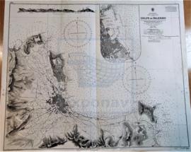
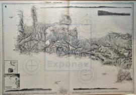
INSTITUTO HIDROGRÁFICO INGLATERRA

MEDITERRANEAN SEA - EASTERN SHEET

  • ES EXPONAV CARTAS NÁUTICAS CCN-000120
  • Pièce
  • 1880
  • Fait partie de CARTAS NÁUTICAS

Zona Geográfica: Mar Mediterráneo
Costas del sur de Italia, Sicilia, Grecia, Turquía, Chipre, Palestina, Líbano, Egipto y Libia

INSTITUTO HIDROGRÁFICO INGLATERRA

GOLFO DE PALERMO

  • ES EXPONAV CARTAS NÁUTICAS CCN-000049
  • Pièce
  • 1873
  • Fait partie de CARTAS NÁUTICAS

Zona Geográfica: Mar Mediterráneo. Costa norte de Sicilia
Costa norte de la isla de Sicilia (Italia), concretamente del golfo de Palermo.

INSTITUTO HIDROGRÁFICO INGLATERRA

CRETE - WESTERN PART

  • ES EXPONAV CARTAS NÁUTICAS CCN-000102
  • Pièce
  • 1852
  • Fait partie de CARTAS NÁUTICAS

Zona Geográfica: Mediterráneo
Isla de Creta. Contiene recuadros con Port Matala (escala 1: 9100), Sphakia (escala 1: 14560) y Anchorage

INSTITUTO HIDROGRÁFICO INGLATERRA

ALGIERS TO C. BOUGARONI

  • ES EXPONAV CARTAS NÁUTICAS CCN-000098
  • Pièce
  • 1867
  • Fait partie de CARTAS NÁUTICAS

Zona Geográfica: Mar Mediterráneo. Algeria
Aparecen las costas de Algeria y Constantine

INSTITUTO HIDROGRÁFICO INGLATERRA

BONIFACIO STRAIT

  • ES EXPONAV CARTAS NÁUTICAS CCN-000038
  • Pièce
  • 1879
  • Fait partie de CARTAS NÁUTICAS

Zona Geográfica: Mediterráneo
Costas de Sardinia y Orsica incluyendo las islas Magdalena, Caprera, Spargui, Lavezzi y Cavallo.

INSTITUTO HIDROGRÁFICO INGLATERRA

Résultats 1 à 10 sur 17