- ES EXPONAV CARTAS NÁUTICAS CCN-000183
- Item
- 1953
Part of CARTAS NÁUTICAS
Zona Geográfica: Marruecos. Costa oeste de África
Costa de Marruecos
INSTITUTO HIDROGRÁFICO INGLATERRA
1 results with digital objects Show results with digital objects
Part of CARTAS NÁUTICAS
Zona Geográfica: Marruecos. Costa oeste de África
Costa de Marruecos
INSTITUTO HIDROGRÁFICO INGLATERRA
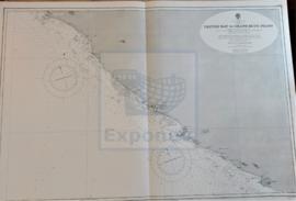
STRAIT OF GIBRALTAR TO THE GAMBIA RIVER
Part of CARTAS NÁUTICAS
Zona Geográfica: Costa oeste de África
Aparece el estrecho de Gibraltar, España, Portugal, Marruecos, Mauritania, Senegal, Gambia. Las islas Canarias, islas Madeira, islas Azores y el archipiélago de Cabo Verde.
INSTITUTO HIDROGRÁFICO ESTADOS UNIDOS DE AMÉRICA
Part of CARTAS NÁUTICAS
Zona Geográfica: Costa oeste de África
Aparecen las tierras de Senegambia, Gambia, Guinea Portuguesa y Guinea Francesa
INSTITUTO HIDROGRÁFICO INGLATERRA
CESTOS BAY TO GRAND BUTU POINT
Part of CARTAS NÁUTICAS
Zona Geográfica: Costa Oeste de África. Liberia
Costa de África desde la bahía de Cestos hasta Gran Butu.
Aparecen los ríos Sangwin y Poa, montañas y ciudades de Liberia.
INSTITUTO HIDROGRÁFICO INGLATERRA
CAPE GHIR TO GARNET HEAD INCLUDING THE CANARY ISLANDS
Part of CARTAS NÁUTICAS
Zona Geográfica: Costa Oeste de África
Costa de África que va desde el cabo Ghir hasta Garnet Head. Aparecen las islas Canarias.
INSTITUTO HIDROGRÁFICO INGLATERRA
Part of CARTAS NÁUTICAS
Zona Geográfica: Costa Oeste de África
Costa desde el río Cacheo hasta lIes de Los. Islas Bissagos y Canal de Orango
INSTITUTO HIDROGRÁFICO INGLATERRA
CAPE ST. ANN TO CAPE THREE POINTS
Part of CARTAS NÁUTICAS
Zona Geográfica: Costa oeste de África
Tierras de Sierra Leona, Liberia; costa de Ivory y costa Dorada
INSTITUTO HIDROGRÁFICO INGLATERRA
ANCHORAGES ON THE WEST COAST OF ÁFRICA
Part of CARTAS NÁUTICAS
Zona Geográfica: Costa oeste de África. Senegal
Contiene 4 recuadros: Rufisque Anchorage (Senegal) a 1:20000 (1875-1876); Portudal Anchorage (Senegal) a 1:30000 (1843); Dakar Road (Senegal) a 1:20000 (1930) y Joal Anchorage (Senegal) a 1:30000 (1910)
INSTITUTO HIDROGRÁFICO FRANCIA
Part of CARTAS NÁUTICAS
Zona Geográfica: Costa Oeste de África. Liberia
Costa de África en la zona de Liberia desde el río Junk hasta la bahía de Cestos. Aparecen los montes Tobacco y Table. Contiene un recuadro con la bahía de Gran Bassa.
INSTITUTO HIDROGRÁFICO INGLATERRA
Part of CARTAS NÁUTICAS
Zona Geográfica: Costa oeste de África
Costa de África que va desde el cabo de San Pablo hasta Lekki. Aparecen los lagos de Denham, Avon, Lagon y Lekki.
INSTITUTO HIDROGRÁFICO INGLATERRA