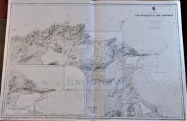
DU CAP FERRAT À LA POINTE KEF EL ASFER
- ES EXPONAV CARTAS NÁUTICAS CCN-000317
- Item
- 1926
Part of CARTAS NÁUTICAS
Zona Geográfica: Costa de Argelia. Mar Mediterráneo
Golfo de d'Arzeu, ciudad de Arzeu, Mostaganem.
INSTITUTO HIDROGRÁFICO FRANCIA
2 results with digital objects Show results with digital objects
DU CAP FERRAT À LA POINTE KEF EL ASFER
Part of CARTAS NÁUTICAS
Zona Geográfica: Costa de Argelia. Mar Mediterráneo
Golfo de d'Arzeu, ciudad de Arzeu, Mostaganem.
INSTITUTO HIDROGRÁFICO FRANCIA
HARBOURS AND ANCHORAGES ON THE COAST OF HAITI AND THE DOMINICAN REPUBLIC
Part of CARTAS NÁUTICAS
Zona Geográfica: Mar Caribe
Contiene 11 recuadros con St. Nicolás Mole a 1:25000; Cayemites Bay a 1:147410; Navassa Island a 1:23280; Acul Bay a 1:53000; Romana River entrance a 1:12500; Gran Pierre Bay a 1:50000; Port Jackson a 1:25180; St. Marc Bay a 1:36640; Jacmel Bay a 1:29150; Port Plata a 1:10100 y Puerto de la ciudad de Trujillo a 1:13130
INSTITUTO HIDROGRÁFICO ESTADOS UNIDOS DE AMÉRICA
ANCHORAGES ON THE WEST COAST OF ÁFRICA
Part of CARTAS NÁUTICAS
Zona Geográfica: Costa oeste de África. Senegal
Contiene 4 recuadros: Rufisque Anchorage (Senegal) a 1:20000 (1875-1876); Portudal Anchorage (Senegal) a 1:30000 (1843); Dakar Road (Senegal) a 1:20000 (1930) y Joal Anchorage (Senegal) a 1:30000 (1910)
INSTITUTO HIDROGRÁFICO FRANCIA
Part of CARTAS NÁUTICAS
Zona Geográfica: Costa de Algeria. Mar Mediterráneo
Aparece la ciudad de Oran, cabo Falcon, bahía de Canastel y cabo de l'Aiguille.
Contiene un recuadro con la bahía de los Andaluces (1931)
INSTITUTO HIDROGRÁFICO FRANCIA
Part of CARTAS NÁUTICAS
Zona Geográfica: Martinica. Indias Occidentales.
Aparece la bahía y el puerto de Fort de France
INSTITUTO HIDROGRÁFICO FRANCIA
PUERTO CABELLO TO RIO ORINOCO AND THE LESSER ANTILLES TRINIDAD TO MARTINIQUE
Part of CARTAS NÁUTICAS
Zona Geográfica: Venezuela. América del Sur
Aparece el mar del Caribe, Venezuela, islas Windward y las islas de Trinidad y Tobago.
INSTITUTO HIDROGRÁFICO ESTADOS UNIDOS DE AMÉRICA
CALAIS TO THE R. SCHELDE ENTRANCE
Part of CARTAS NÁUTICAS
Zona Geográfica: Costa de Francia y Bélgica. Mar del Norte
Aparecen las costas de Francia, Bélgica y el paso de Calais.
INSTITUTO HIDROGRÁFICO FRANCIA
Part of CARTAS NÁUTICAS
Zona Geográfica: Francia costa Oeste
Tierras de Morbiham, Loire inferior y Belle Ille
INSTITUTO HIDROGRÁFICO FRANCIA
Part of CARTAS NÁUTICAS
Zona Geográfica: Francia costa noroeste
Incluye las islas de Sein y Ushant con el puerto de Brest, zona de Francia llamada Finistère
INSTITUTO HIDROGRÁFICO FRANCIA
Part of CARTAS NÁUTICAS
Zona Geográfica: Mar Mediterráneo. Costa norte de Túnez
Aparece la costa tunecina con los lagos de Lishkoel, Bizerte y Porto Farina y el golfo de Túnez.
INSTITUTO HIDROGRÁFICO FRANCIA