Affichage de 46 résultats

Description archivistique
CARTAS NÁUTICAS CARTA DE APROXIMACIÓN Espagnol
Options de recherche avancée
Aperçu avant impression Affichage :

7 résultats avec objets numériques Afficher les résultats avec des objets numériques

ABORDS D'ORAN

  • ES EXPONAV CARTAS NÁUTICAS CCN-000314
  • Pièce
  • 1930
  • Fait partie de CARTAS NÁUTICAS

Zona Geográfica: Costa de Algeria. Mar Mediterráneo
Aparece la ciudad de Oran, cabo Falcon, bahía de Canastel y cabo de l'Aiguille.
Contiene un recuadro con la bahía de los Andaluces (1931)

INSTITUTO HIDROGRÁFICO FRANCIA

ANCHORAGES ON THE WEST COAST OF ÁFRICA

  • ES EXPONAV CARTAS NÁUTICAS CCN-000247
  • Pièce
  • 1875
  • Fait partie de CARTAS NÁUTICAS

Zona Geográfica: Costa oeste de África. Senegal
Contiene 4 recuadros: Rufisque Anchorage (Senegal) a 1:20000 (1875-1876); Portudal Anchorage (Senegal) a 1:30000 (1843); Dakar Road (Senegal) a 1:20000 (1930) y Joal Anchorage (Senegal) a 1:30000 (1910)

INSTITUTO HIDROGRÁFICO FRANCIA

BAHIA DE CARDENAS

  • ES EXPONAV CARTAS NÁUTICAS CCN-000305
  • Pièce
  • 1924
  • Fait partie de CARTAS NÁUTICAS

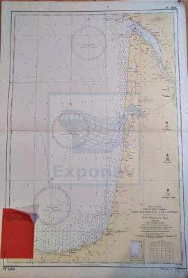
Zona Geográfica: Costa norte de Cuba. Indias Occidentales
Ciudad de Cárdenas y la península de Icacos.
Incluye dos recuadros a escala 1:30000 con el Canal de la Manuy y la parte oeste de la bahía de Cárdenas

INSTITUTO HIDROGRÁFICO ESTADOS UNIDOS DE AMÉRICA

BAHIAS NIPE, LEVISA AND CABONICO

  • ES EXPONAV CARTAS NÁUTICAS CCN-000298
  • Pièce
  • 1932
  • Fait partie de CARTAS NÁUTICAS

Zona Geográfica: Costa norte de Cuba. Indias Occidentales
Aparecen las bahías Levisa y Nipe, la península Ramon, y las ciudades de Antilla y Felton

INSTITUTO HIDROGRÁFICO ESTADOS UNIDOS DE AMÉRICA

BAIA DA ESCARAMUÇA

  • ES EXPONAV CARTAS NÁUTICAS CCN-000004
  • Pièce
  • 1952
  • Fait partie de CARTAS NÁUTICAS

Zona Geográfica: Guinea Portuguesa
Plano de la mitad de la Isla Caravela con la Bahía da Escaramuça y el canal de Caravela

INSTITUTO HIDROGRÁFICO PORTUGAL

BARRY & WATCHET TO NEWPORT & WESTON-SUPER-MARE

  • ES EXPONAV CARTAS NÁUTICAS CCN-000130
  • Pièce
  • 1922
  • Fait partie de CARTAS NÁUTICAS

Zona Geográfica: Costa oeste de Inglaterra. Canal de Bristol
Aparecen las ciudades de Newport, Penarth, Cardiff y Weston-super-mare. Las bahías de Bridgwater y de Cueston.

INSTITUTO HIDROGRÁFICO INGLATERRA

BELFAST LOUGH

  • ES EXPONAV CARTAS NÁUTICAS CCN-000229
  • Pièce
  • 1883
  • Fait partie de CARTAS NÁUTICAS

Zona Geográfica: Costa este de Irlanda
Aparece el condado de Down y el de Antrim. La isla de Copeland
Incluye un recuadro de los muelles de Belfast a escala 1:18000

INSTITUTO HIDROGRÁFICO INGLATERRA

BELFAST LOUGHT

  • ES EXPONAV CARTAS NÁUTICAS CCN-000034
  • Pièce
  • 1883
  • Fait partie de CARTAS NÁUTICAS

Zona Geográfica: Irlanda Costa Este
Entrada al puerto de Belfast, con los puertos de Donachadee, Bangoh y Carrickfergus, y las islas de Copeland y Old Lighthouse

INSTITUTO HIDROGRÁFICO INGLATERRA

CABO MACHICHACO A RÍO GIRONDA

  • ES EXPONAV CARTAS NÁUTICAS CCN-000017
  • Pièce
  • 1952
  • Fait partie de CARTAS NÁUTICAS

Zona Geográfica: Costa oriental España/Francia
Descripción de la costa cantábrica de la zona norte del País Vasco y zona oeste de Francia, con los ríos y puertos más importantes de la zona.

INSTITUTO HIDROGRÁFICO ESPAÑA

CAYO FRANCES TO CAIBARIEN

  • ES EXPONAV CARTAS NÁUTICAS CCN-000304
  • Pièce
  • 1927
  • Fait partie de CARTAS NÁUTICAS

Zona Geográfica: Costa norte de Cuba. Indias Occidentales
Ciudad de Caibarien, cayos Virazon, cayo Fragoso, cayo Herradura y cayo Canuco

INSTITUTO HIDROGRÁFICO ESTADOS UNIDOS DE AMÉRICA

Résultats 1 à 10 sur 46