portulano

Taxonomía

Código

Nota(s) sobre el alcance

Nota(s) sobre el origen

Mostrar nota(s)

Términos jerárquicos

portulano

Términos equivalentes

portulano

Términos asociados

portulano

38 Descripción archivística results for portulano

38 resultados directamente relacionados Excluir términos relacionados

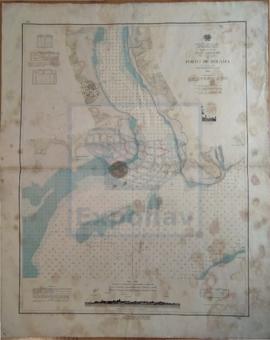
PLANS OF ANCHORAGES ON THE WEST COAST OF SICILY

  • ES EXPONAV CARTAS NÁUTICAS CCN-000096
  • Unidad documental simple
  • 1900
  • Parte deCARTAS NÁUTICAS

Zona Geográfica: Sicilia. Italia
Recuadros con la rada de Sciacca, el puerto de Favignana, el puerto de Marsala y el puerto Empedocle

INSTITUTO HIDROGRÁFICO ITALIA

PLANS ON THE NORTH COAST OF CUBA

  • ES EXPONAV CARTAS NÁUTICAS CCN-000301
  • Unidad documental simple
  • 1930
  • Parte deCARTAS NÁUTICAS

Zona Geográfica: Costa norte de Cuba. Indias Occidentales
Carta dividida en dos recuadros: en el primero aparecen las bahías de Bariay y Jururu y las puntas de Sotavento y Barlovento a escala 1:10000; en el segundo la bahía Vita y el puerto Vita a escala 1:10000

INSTITUTO HIDROGRÁFICO ESTADOS UNIDOS DE AMÉRICA

PLANS ON THE SOUTH COAST OF WALES

  • ES EXPONAV CARTAS NÁUTICAS CCN-000132
  • Unidad documental simple
  • 1949
  • Parte deCARTAS NÁUTICAS

Zona Geográfica: Islas Británicas
Aparece la bahía de Swansea y los alrededores de Porthcawl

INSTITUTO HIDROGRÁFICO INGLATERRA

PORT D'ALGER

  • ES EXPONAV CARTAS NÁUTICAS CCN-000326
  • Unidad documental simple
  • 1921
  • Parte deCARTAS NÁUTICAS

Zona Geográfica: Costa de Argelia. Mar Mediterráneo
Portulano del puerto de Argel.
Incluye un recuadro de Mouillage de la Pointe Pescade

INSTITUTO HIDROGRÁFICO FRANCIA

PORT DE BOUGIE

  • ES EXPONAV CARTAS NÁUTICAS CCN-000322
  • Unidad documental simple
  • 1922
  • Parte deCARTAS NÁUTICAS

Zona Geográfica: Costa de Argelia. Mar Mediterráneo
Proximidades del puerto de Bougie con los cabos de Carbon, Noir y Bouak

INSTITUTO HIDROGRÁFICO FRANCIA

PORT DE MOSTAGANEM

  • ES EXPONAV CARTAS NÁUTICAS CCN-000318
  • Unidad documental simple
  • 1926
  • Parte deCARTAS NÁUTICAS

Zona Geográfica: Costa de Argelia. Mar Mediterráneo
Puerto de Mostaganem

INSTITUTO HIDROGRÁFICO FRANCIA

PORT OF NAPLES

  • ES EXPONAV CARTAS NÁUTICAS CCN-000228
  • Unidad documental simple
  • 1949
  • Parte deCARTAS NÁUTICAS

Zona Geográfica: Costa oeste de Italia. Mar Mediterráneo
Aparece el puerto de Nápoles y calles adyacentes

INSTITUTO HIDROGRÁFICO ITALIA

PORTO DE BISSAU

  • ES EXPONAV CARTAS NÁUTICAS CCN-000014
  • Unidad documental simple
  • 1948
  • Parte deCARTAS NÁUTICAS

Zona Geográfica: Guinea portuguesa
Puerto de Bissau, islote do Rei e islote dos Pássaros

INSTITUTO HIDROGRÁFICO PORTUGAL

PORTO DE BOLAMA

  • ES EXPONAV CARTAS NÁUTICAS CCN-000003
  • Unidad documental simple
  • 1949
  • Parte deCARTAS NÁUTICAS

Zona Geográfica: Guinea Portuguesa
Plano de la entrada al puerto de Bolama. Contiene un grabado del faro de Punta Colonia visto desde el sur-oeste

INSTITUTO HIDROGRÁFICO PORTUGAL

PORTS AND ANCHORAGES IN YUGOSLAVIA

  • ES EXPONAV CARTAS NÁUTICAS CCN-000237
  • Unidad documental simple
  • 1950
  • Parte deCARTAS NÁUTICAS

Zona Geográfica: Mar Mediterráneo. Mar Adriático
Carta dividida en 10 recuadros: Luka Ploce a 1:12000; Luka Polace a 1:24000; Zaliv Klek Neum a 1:36000; Usce Neretve a 1:36000; Luka Pomina a 1:36000; Kanal Malog Stona a 1:36000; Luka Zaton a 1:24000; Luka Slano a 1:24000; Luka Gruz a 1:24000 y Dubrovnick a 1:36000.

INSTITUTO HIDROGRÁFICO YUGOSLAVIA

Resultados 21 a 30 de 38