Identity area
Reference code
ES EXPONAV CARTAS NÁUTICAS CCN-000078
Title
MEDITERRANEAN AND BLACK SEAS
Date(s)
- 1956 (Accumulation)
Level of description
Item
Extent and medium
1 carta náutica
Escala
Tamaño 59,5 x 33 cm
Col.
Context area
Name of creator
Biographical history
Repository
Archival history
Immediate source of acquisition or transfer
Content and structure area
Scope and content
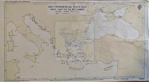
Zona Geográfica: Mar Mediterráneo
Visión del Mar Mediterráneo en la que están marcadas las zonas peligrosas y el Mar Negro.
Appraisal, destruction and scheduling
Accruals
System of arrangement
Conditions of access and use area
Conditions governing access
Conditions governing reproduction
Language of material
- English
Script of material
Language and script notes
Physical characteristics and technical requirements
Material de la carta náutica: papel
Estado de conservación Bueno
Finding aids
Allied materials area
Existence and location of originals
PLANERA 16
CAJÓN 2
Existence and location of copies
Related units of description
Notes area
Note
Carta no utilizada para navegar
La fecha 1956 corresponde a la última corrección realizada sobre el mapa
Note
Número de carta: s. 6684
Alternative identifier(s)
Access points
Subject access points
Place access points
Name access points
Genre access points
Description control area
Description identifier
Institution identifier
Rules and/or conventions used
Status
Level of detail
Dates of creation revision deletion
Language(s)
Script(s)
Sources
Digital object metadata
Filename
000078_MEDITERRANEAN_AND_BLACK_SEAS.pdf
Latitude
Longitude
Media type
Text
Mime-type
application/pdf
Filesize
2.1 MiB
Uploaded
November 23, 2020 12:23 AM